- Introductory pages
- Historical Survey
- Rare & Valuable Things
- Baghdad...
- Land of Antiquity
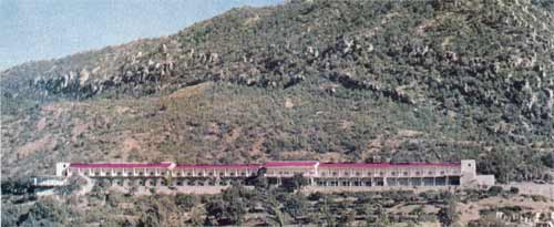
- Summer resorts
- Frontier formalities
- Diplomatic missions
- Hotels and rest houses
- Banks
- Additional Information
- Cafes and restaurants in Baghdad
- Amusements in Baghdad
- Museums in Baghdad
- Hospitals and Pharmacies in Baghdad
- Communications and Transport
IRAQ A GUIDEBOOK
CONTENTS (pdf format)
SITE
HOME PAGE
IRAQ 1961

The land between two rivers
TEXT
A Text-Only Version,
about 131kb, with links to the photographs. This version is best for those with a slow downloading connection.
Archaeological Site Maps of Iraq: A detailed map showing the location of the numerous archaeological and monumental sites.
Illustrated Map of Iraq: A detailed map showing sights and areas of historic and geographic interest.
Communications & Transport Maps of Iraq (1958-1961): These maps give the rail and road routes.
Baghdad City: A plan of Baghdad City (1959)
Iraq Summer Resorts: Map of the north region of Iraq.