|
|
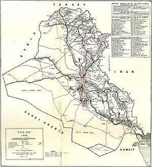
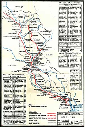
Click on either of the small pictures to download in separate windows the two maps illustrating the road and rail network in Iraq, up to the year 1961. Both are in great detail.
The map on the left shows the road network. Its size is 339kb and measures 63.96cm wide x 70.06cm high. (Your browser should have a method of enlarging the picture to its saved size.)
The map on the right shows the rail network. Its size is 304kb and measures 44.52cm wide x 66.53cm high. (Again, your browser should have a method of enlarging the picture to its saved size.)
|
|